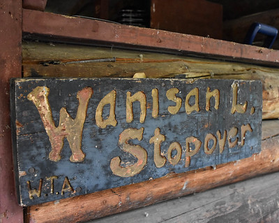
When it was determined that a shelter in the Wanisan Lake area would be desirable, it was naturally Stan Skirrow who scouted around and selected the location.
The location he chose was ideal for several reasons: It was not too distant from a road, it had a fairly open aspect and a great view, and it was favoured by wildlife. Wildlife naturally gravitate to location like these and use them as rest areas, because for one thing, these areas are relatively free of insects.
The location is on Crown land and so a lease agreement with the Alberta Government was duly worked out and signed.
Materials arrive with some help
A major stipulation of the lease was that we had to erect two outdoor toilets—one for each gender. We were unable to convince the government that one unisex toilet would do nicely. The law required two toilets, period. This was notwithstanding the fact that participants of any group, whether hiking or skiing, would simply drop back briefly and avail themselves of the cover of bushes to answer the call of nature along their way.
Fortunately, arrangements were made with a school group who made a project of building two lightweight sectional toilets for us. The group also delivered and erected them.
Logs for the shelter were also obtained as a project. The Canadian Army secured them in the Alberta foothills and delivered to them to the lakeshore.
But we still needed to float the logs across the lake to the site. This was my first involvement with the Wanisan project. A work party led by Stan Skirrow, as I recall, and comprising high school students with a boat, was formed to tow the logs across to the shelter site. The floating logs were contained by a boom and several of the boys set off with the boat to tow the logs across.
They immediately developed engine trouble and spent much time trying to get the motor going. They finally gave up and proceeded to row the boat, towing the logs across.
Once across, they were met by the rest of the gang who immediately hauled the logs ashore and stacked them. I cannot remember the names of any of the others who were present that day.
Autumn work
Summer turned to autumn, and on a Friday evening after work, a work party assembled to pour the footings for the proposed shelter. I am guessing, but the half-dozen of us present would likely have included Stan Skirrow, of course, and probably Stan Peters, Jim Drouin, and Vince DeJong. I regret having no photos or listing of names of those present.
The plan was to take all the materials across the lake by canoe. Into the canoe went the bags of ready-mix cement, the shovels and lumber, miscellaneous tools, and the wheelbarrow in which to mix the cement.
Stan Peters and I paddled, and when we got to the building site, the others, who had left and hiked along the lake while we were loading the canoe, already had the locations laid for the footings. The forms were made quickly and the cement was transported from the shore to the site.
At this time of year the algae was very thick and heavy so we had to paddle out past the algae to get clear water to mix with the cement. Several trips with five gallon pails did the trick and soon the footings were poured in place.
When the work was done, we sat by the fire and enjoyed our lunch contemplating the beautiful evening for some time after the sun set. As the fire died down we packed the remaining materials into the canoe and Stan and I set off across the lake while the others walked back. We left the wheelbarrow inverted in the canoe, with the handles sticking out forward and the wheel up. Then paddling away, it dawned on us that this being autumn, it was hunting season. We grew antsy about the possibility of some hunter walking along the lake and seeing our profile in the water, mistaking it for a moose and taking a shot at us. We paddled harder and talked loudly until we got to the other side.
Winter hauling
That winter the dimensional lumber was purchased and deposited at an access point at the south west corner of the frozen lake. We would have to truck it across. The cabin unit on the truck was filled to the top with the lumber.
Then on a Saturday morning, a work party assembled at the edge of the lake. Present were Stan Skirrow, Jim Drouin, Gene Miskiw, Len Black and his son Rob, who owned the truck, and a friend of Rob.
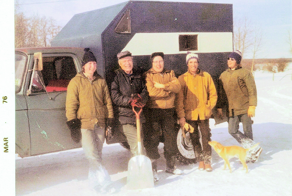
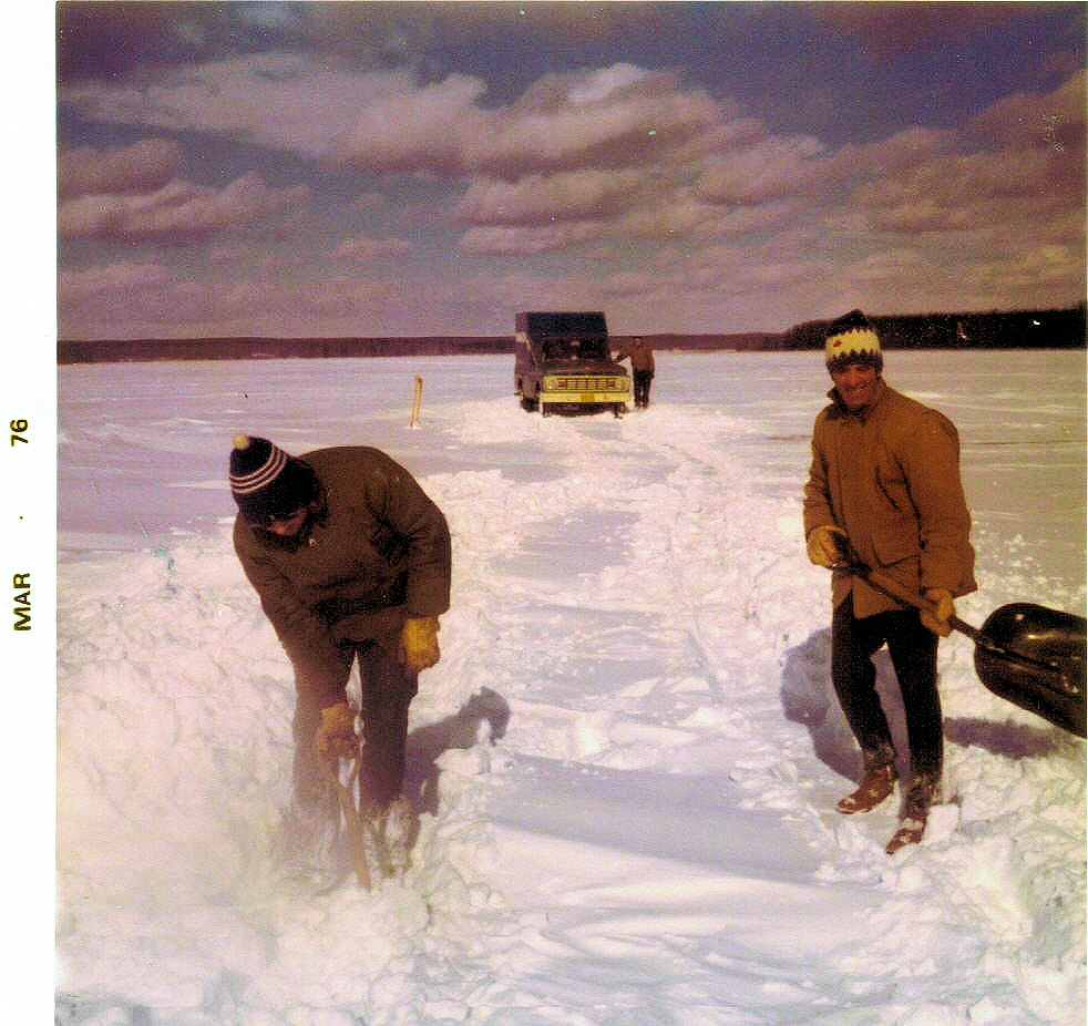
There was a brisk wind that day and snow was drifting constantly. We first had to shovel a long route through the snowdrifts to get the truck onto the lake. Once there, the truck was able to make way across the lake quite well and we all rode along, some of us on the tailgate.
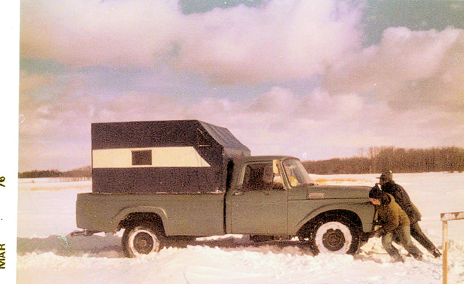
At the building site, we were unable to drive very close to the shore due to the heavy snow and there again we had to shovel a narrow path to enable us to carry the lumber to the site and stack it on some logs. The snow in some spots was hip deep and the increasing drifting was creating little cornices which would break off with our passing as the wind continued to pick up.
After the truck was unloaded we discovered that we were unable to make way again without the traction that was provided by the weight of the lumber. The hardpack on the ice was not hard enough to support the truck. It offered too much resistance for the amount of traction available on the ice beneath. Our old tracks were filled in with hardpack that also offered too much resistance on the already polished ice beneath. With some experimentation we found that the only way to move forward was to scuff the snow out of the incoming tracks with our feet for a distance, then get on the tailgate for ballast and take a run with the truck as far as it would go. Then we would repeat the operation over and over. Eventually we made it all the way back across the lake over a mile away where, once again, we had to do some shoveling to get the truck off the lake.
This whole operation took us a number of hours of hard work. Eventually we arrived at Len Black’s place, tired and hungry. Pat Black, who was getting very concerned as we were so long overdue, was waiting for us with a large pot of chili.
Construction
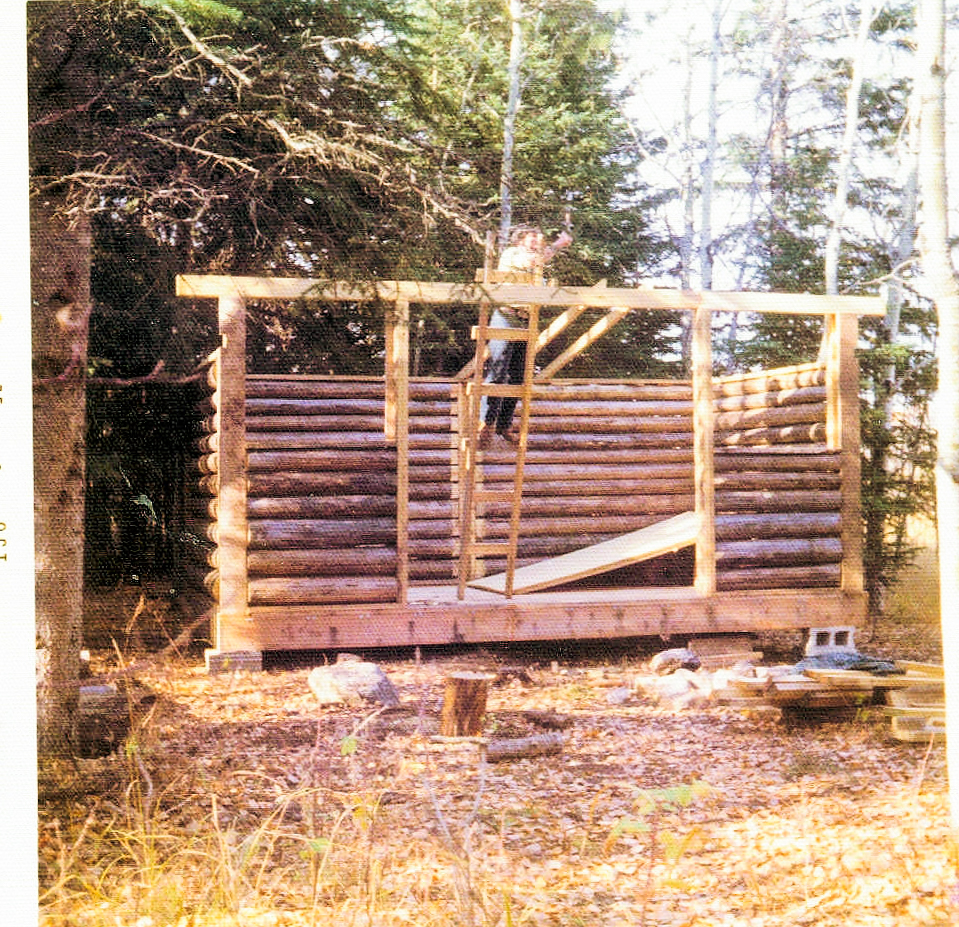
In the following summer, 1976, serious construction of the shelter was undertaken. Unfortunately, I have no photos or names of the participants other than a few which show Stan Skirrow, Stan Peters and Vince DeJong at the site. Some weekends my family and I camped there and did some work, sometimes with a family friend, Gilbert Hemmes. The location has always been one of my favorite places on the trail.
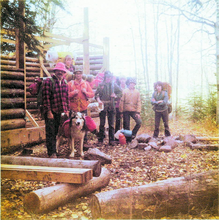
Whenever I worked at the site we would always take across by canoe anything required for the other side. Sometimes it was tools and whatever shorter lumber we could fit into the canoe, with plywood across the gunwales and then sixteen- foot lumber diagonally on top of that with our camping gear and a garbage can or two.
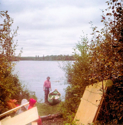
On one occasion Stan Peters and I had an incredible load which included six inches of plywood across the gunwales. We had some cement blocks in the hold for the shelter foundation, which significantly added to the weight. We tried to estimate the weight of the load including our own weight and were fairly certain that it approached 1000 pounds. We had only three inches of freeboard left and were happy to have calm water for the trip across.
Animal invasion
Once the shelter was built, we had, for a time, a problem with horses taking refuge in the shelter and creating a mess. So we had to bar the entrance against them.
Another winter hauling adventure
One year, we were hauling boardwalk lumber by snowmobile to a location beyond the shelter. A friend and I picked up the lumber and delivered it to the edge of the lake, and we went back to Sherwood Park to pick up the snowmobiles and sled so we could haul the lumber to its destination.
When we started hauling the lumber across the lake we found that progress was very difficult. Because it was such a lovely warm March day, the deep snow was wet and sticky. We had so much difficulty trying to get off the lake that we decided to give up. We were exercising the Law of Diminishing Returns. We knew it would be much easier when the snow was dry, so there was no point in trying to do it the hard way.
The loaded sled was already partially buried in the deep snow. All we had to do was throw on some more snow to camouflage it and we left it behind for the day. Early the next day, we came back while the snow was still frozen and dry. We broke the sled free, and away we went. That day we made several trips—with ease—until we completed the job. We finished the day at the shelter, having our lunch in beautiful sunshine.
Epilogue
For over forty years, Wanisan Shelter has been a treasured place on the Waskahegan Trail. Each year, since 2017, we’ve held of a Saturday evening hike and barbecue in the late spring. With a 5 o’clock start time, there are plenty of hours and many opportunities to see beavers and muskrats active on the ponds between the shelter and the Blackfoot Recreation Area. After the walk, we gather around the campfire to roast our dinners and tell stories about the trail.
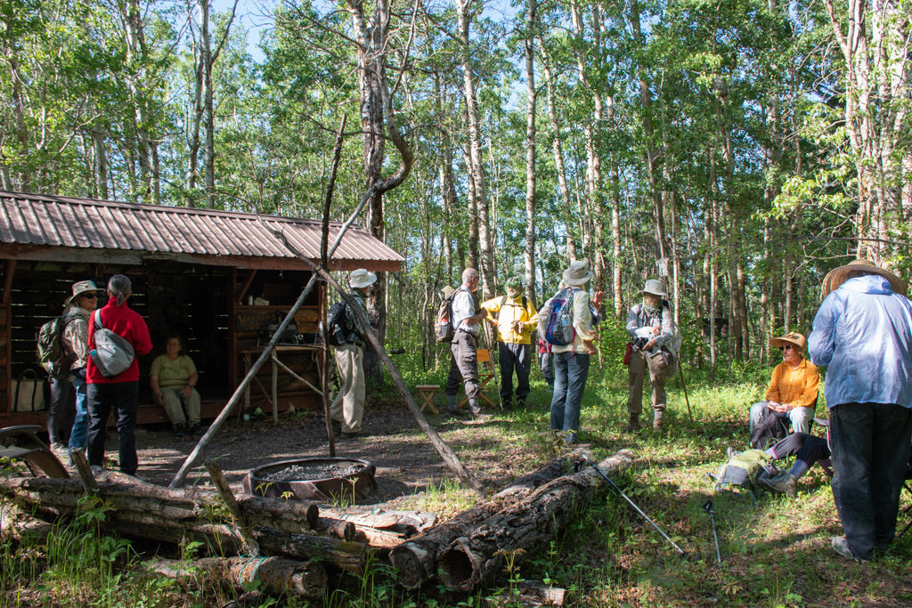
You can see more of Gene’s photos on the Wanisan Shelter album on Flickr.
